Insight Dispatch
Insight Dispatch is a powerful GIS solution designed specifically to meet the needs of public safety agencies.
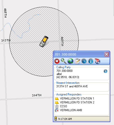 All 911 call information is presented within the map display, including latitude and longitude of callers allowing dispatchers to see all key data at-a-glance.
Call locations are displayed for landlines, wireless (Phase I and Phase II), VOIP calls, as well as manually tagged calls.
Quickly create routes for emergency responders with turn-by-turn directions.
Fax, print, or email driving directions for emergency responders.
Search for addresses within the map by names, streets, and more.
Quickly locate latitude and longitude coordinates.
Toggle map layers with just a click to view aerial photography and more.
Default response agencies can be determined based on location of calls.
Estimated locations for wireless callers are displayed with uncertainty values.
An outbound ENS Notification interface is available.
Insight Dispatch is designed to be self-teaching, so that anyone can effectively learn to use the numerous tools.